Overview
More than 220 hectares of forested area was severely affected within the Dandenong Ranges National Park in the 2021 storms. In some areas, as much as 90% of the tree canopy blew over or snapped off.
Forest Fire Management Victoria (FFMVic) has led the recovery effort in the Dandenong Ranges. Partners include Parks Victoria, Melbourne Water and Yarra Ranges Shire.
FFMVic removed debris from tracks and roadsides to ensure safe access for firefighters and the community. The works affected less than 1.5% (50 hectares) of the 3540-hectare Dandenong Ranges National Park. These were not commercial timber harvesting operations.
Debris was only removed in areas where it created a bushfire or other safety risk. Standing trees were only removed where they were assessed as hazardous and were a risk to safety. Learn more about managing fire risk
Where appropriate, fallen trees were left for wildlife habitat.
All roads, tracks and fuel breaks have been reopened.
Before clean-up
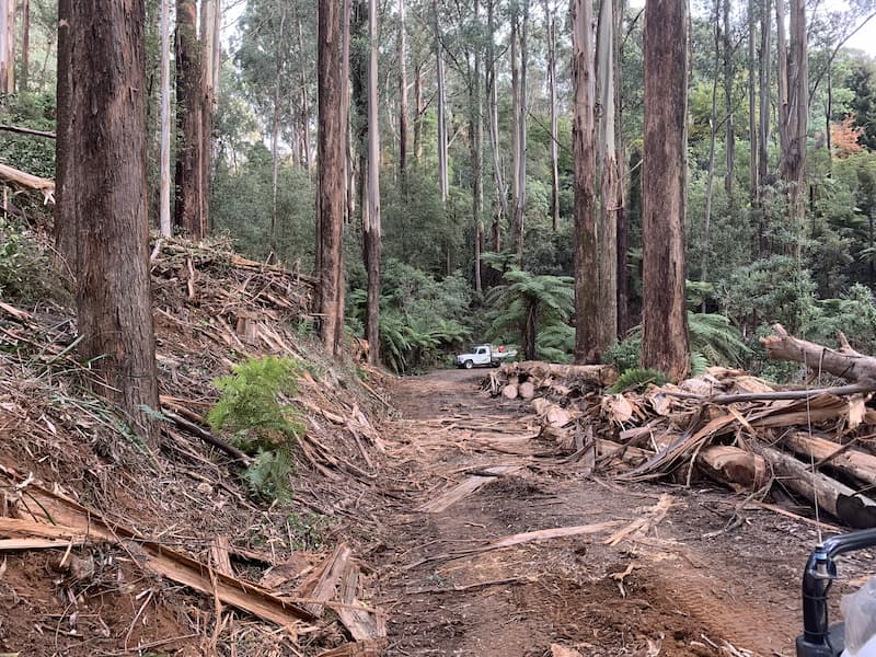
Mathias Track, Dandenong Ranges National Park
After clean-up
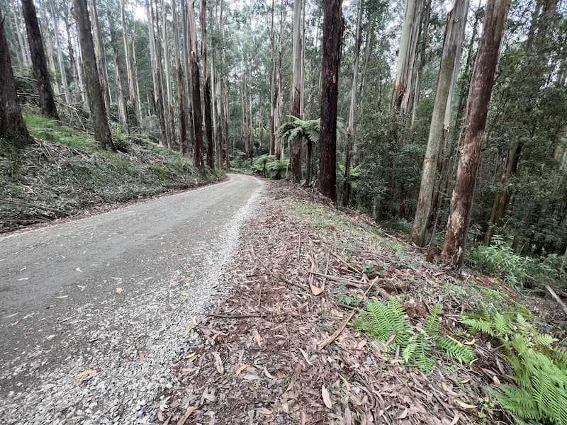
What work was carried out?
Fallen debris has been removed from roadsides along key fire access roads and fuel breaks. This includes up to 40 metres either side of the tracks. Standing trees were only removed where they were assessed as hazardous and were a risk to safety.
These works removed obstacles at the site. They allow fire crews to respond more quickly, safely and effectively to a bushfire.
The works ensure a safer work environment for crews conducting planned burns. They also allow crews to conduct most of the work from the existing tracks.
What is happening to the debris once it's removed from the park?
Debris has been made available for firewood collection near Powelltown.
Fallen hollow logs and rootballs were provided for:
- fish habitat along streams
- habitat in Lysterfield Lake Park
- Werribee Zoo animal enclosures, and more.
Parks Victoria and Zoos Victoria have used finished timber products for bollards, sleepers, log seats, mulch, picnic tables and tree stakes.
Victoria's State Forest By-Products Framework now guides how any debris is distributed.
What progress has been made so far?
- 71.7 hectares have been treated,all works are now complete
- hazardous trees have been removed from 350 km of roads, and roads reopened
- 100 artificial hollows/nest boxes installed
- 10 recreation areas have been reopened
- 9 walking tracks (60 km) reopened.
What is the bushfire risk in the Dandenongs?
The Dandenong Ranges is heavily populated. Many people live in or near the forest with few escape routes. The nearby Silvan Reservoir provides 82% of Melbourne's drinking water, which would be at risk in a major bushfire in the area.
A bushfire in this area could significantly impact:
- people
- biodiversity and wildlife
- critical infrastructure including water catchments, and
- the local economy.
For these reasons, the Dandenong Ranges has the highest bushfire risk in the Greater Melbourne region.
How do you protect the environment during these works?
We prioritise the protection of environmental, biodiversity and cultural values during all recovery and bushfire risk reduction works.
Learn more about how we manage environmental values.
Apart from debris removal and planned burns, how do you manage fire risk?
We work year-round alongside partner agencies, local government and communities to develop and deliver the Joint Fuel Management Plan (JFMP).
As well as planned burning, we lower bushfire risk by:
- slashing
- mulching or
- removing excess vegetation.
Useful links
Page last updated: 03/07/26